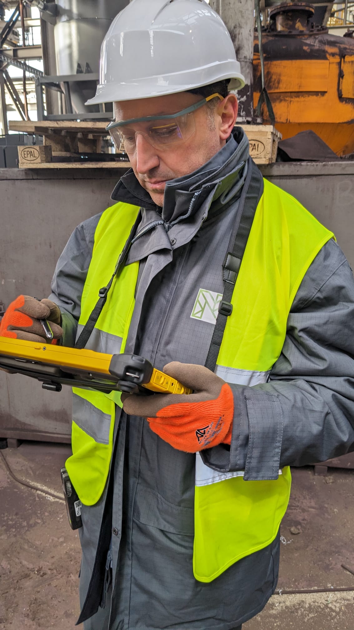
The Laser Scanner 3D system, thanks to the perfect integration with other software, offers high performance in a compact format and in total simplicity, to ensure maximum effectiveness in the field.
With all perfectly recorded and aligned scans, which can be exported directly to the formats required by the most popular point cloud processing software, you can finish your work in the field. It is an “open” system designed to make it even more productive and a Field to BIM solution in all respects.
The laser optimizes the process by directly exporting correctly recorded point clouds in the formats E57, LAS, RCP, POD, PTX, TZF, TDX.
Software and Services
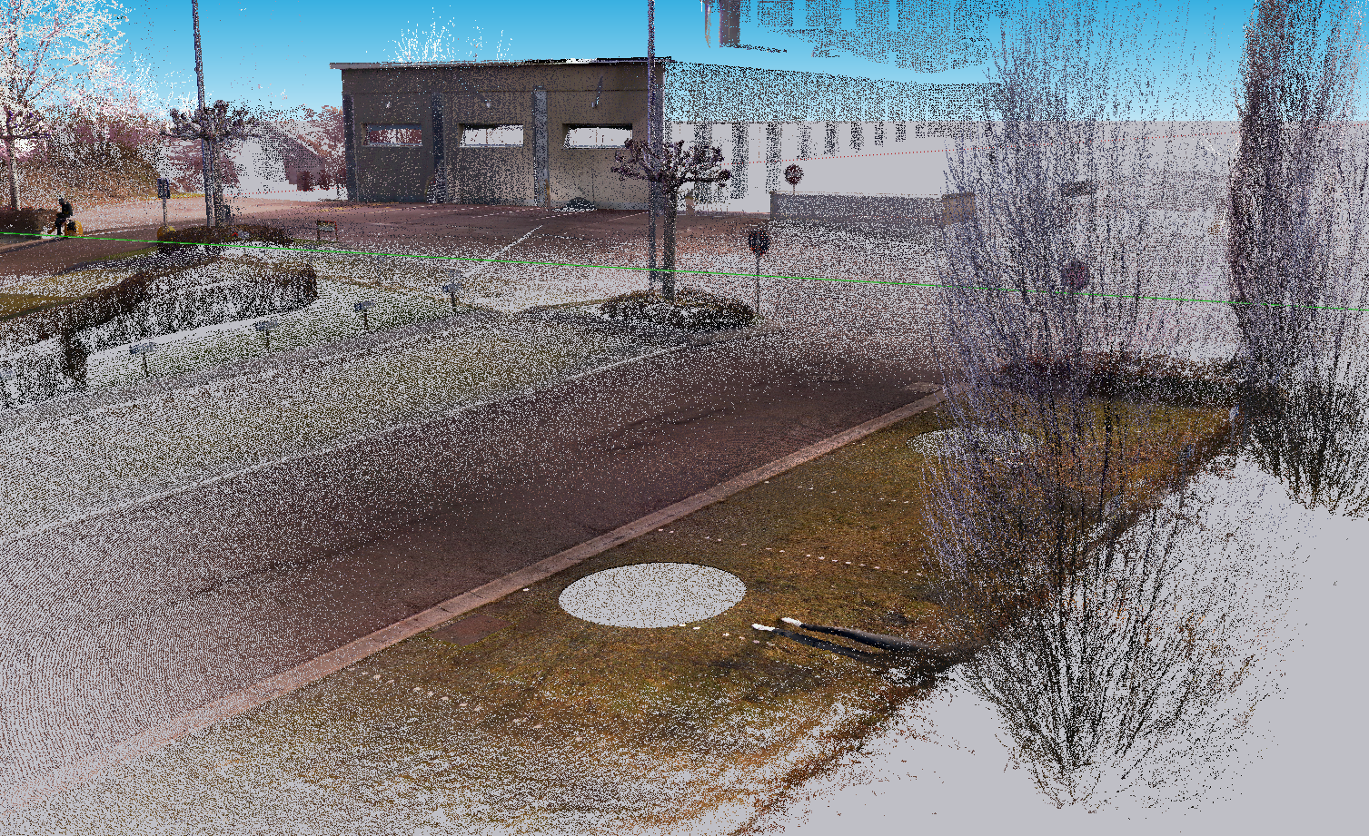
Laser Scanner survey
Point Cloud optimization with Realworks software
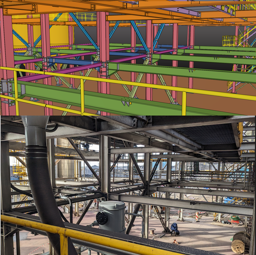
Point cloud versus digital models comparison
Return of a digital model
Create a Landscape with Sketchup
On-site visualization of the augmented reality project developed through Site Vision
Servizi e Software
Case Studies
Shipyard in Holland
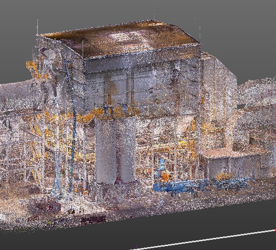
For a steel manufacturer we conducted an on-site laser scanner survey using the laser scanner.
Then the point cloud was optimized, exported and compared to the Tekla digital model, which was updated according to changes made to the existing structure.
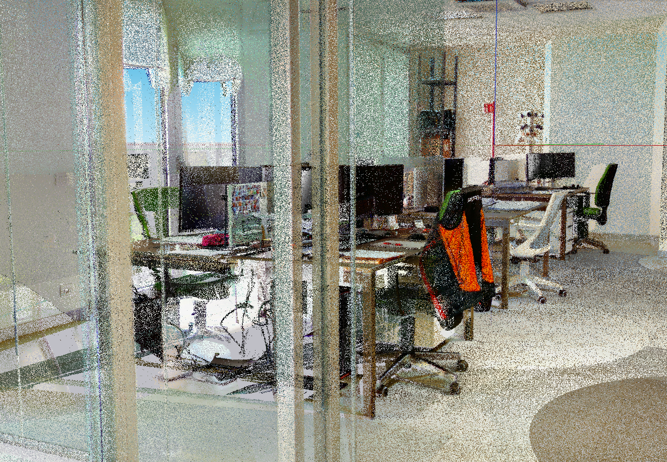
Point Cloud of an office
In this case the point cloud has been created in an office so that you could view each individual room and compare it with the current project.
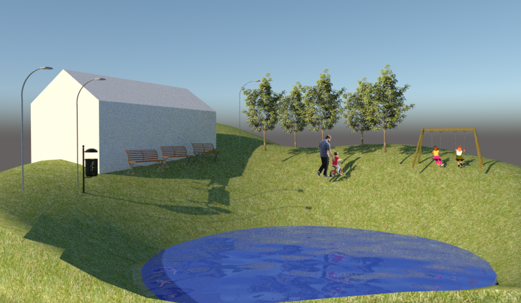
Landscape Changes
In view of a renovation was made the survey and created the point cloud.
Through Sketchup the context has been modified and the changes made by the renovation have been added.